November 4, 1922 - Allen Chamberlain
Article about the Wapack Trail as it was being planned
Prospecting for a New High Level Route Between Massachusetts and New Hampshire - From Watatic to Pack Monadnock By Allen Chamberlain

   ANYONE whose legs are restless for A the want of a little cross-country exercise, and more especially if he yearns to take it a bit in the rough through a region largely guiltless of well-blazed trails and path signs, will find something quite worthy of his attention among the hills of northern Worcester county, Massachusetts, and the young mountains that stretch northward into eastern Cheshire county, New Hampshire. If present plans carry, another year will find a well-marked trail leading through that section from Ashburnham on the south to Pack Monadnock mountain on the north, and perhaps beyond over Lyndeborough mountain to the Uncanoonucs. At this season, when the highland hardwood forests are dressed in all their autumn finery, and when the days, though short, are apt to be clear and cool, nothing can be more inspiring than a two or three days tramp across the upland pastures, richly decked with the russet and gold of frosted bracken, through the gaily painted hardwoods, and up along the spruce-grown rocky ridges commanding wide panoramas including landmarks in three States. Once a way has been blazed across this range of hills It will unquestionably become a popular route, not alone because of its attractiveness, but owing to its accessibility to several large population centers.

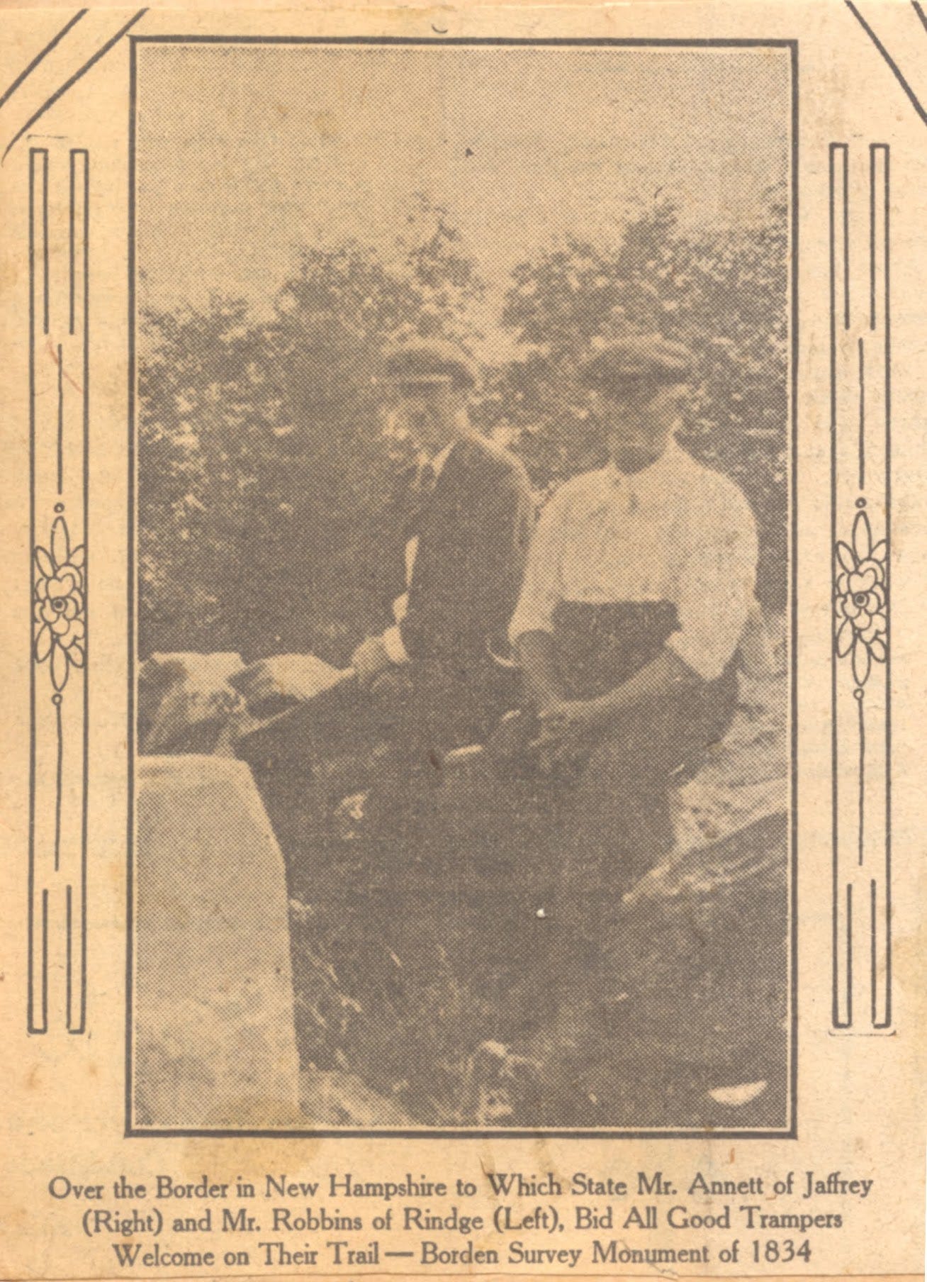
   The plan for this trail originated with two New Hampshire gentlemen, Mr. Albert Annett of Jaffrey and Mr. William F. Robbins of Rindge, and they are minded to see it through as a piece of public service, leading to the opening up of a neglected natural attraction of their section. Under their guidance I spent a delightful week- end footing it over the section where most of the trail-cutting will be required, from Watatic Mountain, just south of the Massachusetts-New Hampshire boundary, to the Pack Monadnocks, two days of easy walking to the north. Even in its present unmarked state the route can be readily followed by anyone who has woods lore enough to trace his way from landmark to landmark. The blind places to be watched for are few and short, and the landmarks to be aimed at are prominent and unmistakable Armed with a good compass, and with copies of the Geological Survey's Fitchburg and Peterboro quadrangles, the trip becomes a delightful exploration. especially for one who carries a light outfit and camps along the way, for attractive campsites, well supplied with wood and water, abound. For those who prefer to go it light, good lodgings are available in Sharon at the end of the first day, and other similar stop-over stations will be arranged for later farther on. At present, unless one is prepared to camp, or learns from other sources of a lodging place near the gap, on the State road between Peterboro and Wilton, south of Pack Monadnock, it will be necessary to telephone from the Sanders farm in Sharon, the first night's stopping place, for s conveyance to meet one late in the afternoon on the gap road, Both Peterboro and Wilton are on the railroad. (to be continued)
Mr. Robbins and Mr. Annett
One Hundred Formulas -
George Carmichael donated a copy of Stephen A. Thayer’s “One Hundred Formulas” which was published in 1883. It contains recipes from everything from printing ink to pain killers. More lead for your hair with this concoction.
This book sold for a dollar and was one of the many enterprises that Steven A, Thayer was involved with (He had a cigar factory too). He had some advice for preparing the recipes.
James Roger diary entry
October 20th 1908 (Tuesday)
Cold and clear. David on roads down town. I finished the Gordon lot. Mother helping me to fix stones also raked some leaves.


Is the original Wapack Trail still intact with camping sites maintained?
James and his wife were 'fixing stones'. Are these gravestones?