Prospecting for the Wapack Trail (Conclusion)
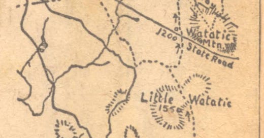
A map and side discussion of the Temple Glass-Works
November 4, 1922 - Allen Chamberlain
The conclusion of Allen Chamberlain’s trek along the proposed Wapack Trail
Returning next morning we took the old road mentioned above, crossed the old stone bridge, and in another half mile came out in the clearing at the old Livingston place, in the saddle between Wildcat Hill and Kidder Mountain another long-deserted farm whose big house was the birthplace of a family of seven daughters, celebrated throughout the countryside of the day as "the handsomest gals" ever seen.

   Wildcat and Kidder are both easily climbed over the open pastures from this point, and in passing it is interesting to note that Kidder is named for one of the earliest settlers of this region, Reuben Kidder, who was the country squire of his time and the official representative in these parts of the Masonian Proprietors at Portsmouth, the land company which brought about the development of a large portion of New Hampshire.

   From the Livingston place the old road descends along the northwest flank of Kidder Mountain, and in a few minutes encounters a wire fence built on the town line between New Ipswich and Temple. Half a mile farther on the right, another old road leaves on the right, the Todd road, as it was called in olden times for one of a dozen families who lived back there on the mountain. This road is also noted because it leads to what is said to have been the oldest glass works in America, and for those who have the time it will be worth while to make a side trip in for half a mile or so to the site of the old furnaces. Here, so the story goes, one Robert Hewes, a soap and tallow chandler of Boston, went, about the year 1780, to set up a glass industry. With him were several Germans, deserters from the Hessian forces of the British Army, who had been skilled glass blowers at home. All the material for the furnaces had to be brought by ox carts from Boston, a slow and toilsome journey of seventy or eighty miles. One inevitably wonders why this remote spot, far back on the mountainside, and so far from any large market, should have been chosen. There were no particularly desirable local supplies essential to the business that could not have been had as readily in hundreds of other places there and elsewhere. There was no necessity for hiding the Hessian workmen from the British either, for In 1780 they would have been quite as safe from capture on the streets of Boston. Safety from prying eyes was a necessity, however, where the development of an industrial monopoly was involved in land had prohibited glass-making in the colonies. The war had stopped the importation of European glass, except, perhaps at prices that the struggling young nation could not afford to pay. As a result anything glass was hard to get when Hewes set up his plant on Kidder Mountain.

Before the Days of Protective Tariffs

   When he rounded up his Hessian glass makers he probably thought that he had cornered the market, and that all he had to do was to keep that corner dark. But luck was against him. About as soon as the plant was built it was accidentally burned, and although the Town of New Ipswich did what it could to restore his fortunes by helping him to rebuild, and in spite of the exemption from taxation granted by the State, they do not seem to have made much glass except perhaps what were known as "Junk" bottles. Then the war ended, and European glass became once more available, at prices with which the Infant industry could not compete. The forest drew a veil over the remains of its abandonment, Mr. Hewes returning to Boston to retrieve his fortunes as a soap maker and fencing master.

   Back on the old road to the north again a half mile more brings one to the highway leading through Spofford Gap to Temple village, and at its junction with another traveled road running north through Sharon. A hundred feet or so east on the Gap road is the sign-post marking the line between Temple and Sharon from which point that line makes straight for the summit of Temple moun- tain and follows its crest for something like three miles. Although the trail is destined to follow that boundary line along the ridge it is not likely that the ascent will be made from this spot owing to the excessive steepness of the cliffs on that southwestern front. If, instead, the road to Sharon is followed for half a mile a bar- way will be found opening to a path up through a brushy pasture, which, in twen- ty minutes, will end at the open ledges atop the southerly spur. For those who have telephoned ahead for quarters at Grand View Farm, the ancestral homestead of Mr. and Mrs. B. H. Sanders, whose post- office by the way is Peterboro, N. H., the highway should be followed for an eighth of a mile beyond the barway to the first house on the right.

Beating the Town Bounds

   A considerable portion of the way along the Temple mountain ridge is through the woods, but outlooks are frequent, and the course is neither difficult to follow nor tame. Just before entering the wooded section a town boundary stone marked 1917 will be found at an elevation of about 1700 feet, from which point it is only necessary to keep on the height of land, but more or less in touch with its easters declivity. At the end of a quarter of an hour in the woods a stone wall will be passed over, and in another quarter-hour a second one reached. Within a few rods there should be a corner made by the intersection with a wall running north. That wall, which in on the town line, should be kept in sight for half an hour longer to its junction with one dropping down, the western slope. This is close to the highest point on the mountain (2100 fent), just easterly of the wall corner, beyond which is a sharp descent into a saddle, through which a provincial road once led. One more summit (2000 feet) has to be topped beyond the road location, from which point there is a rapid drop northwesterly to aл expanse of ledgy pasture with a series of minor knobs.

   Ahead rises South Pack Monadnock, with its carriage road to the summit. Once over the knobs the automobiles can be heard tolling up the Peterboro Road through the pass below. To reach that road there is as yet no known best way. Just take a course and slide down through the woods. The road runs east and west and cannot be missed.

   With another day to spare the Pack Monadnocks can be crossed to the railroad at Russell and beyond that are the Lyndeboro Hills again. there and the Uncanoonucs, across which one can prowl for a day or two more to a connection with the trolley into Manchester. Once the trail has been cut the walking time will be materially reduced for those who must needs hasten their steps, though certain it Is that no one will feel any inclination to set  a rapid gall over that winsome Landscape.

Key to Map

The dotted line on the man is not a trail Key to Map - - - yet. It is a feasible way through and will be cleared and blazed in the near future if present plane carry. The route between Ashburnham village and Watatic Mountain, over Little Watatic, in said to be attractive, hut was not covered  by by the reconnoitring party. The The trip may easily be extended north of the Pack Monadnock over Lyndeboro Mountain and Piscataquog Mountain, which its east of Russell Station on the railroad. Numerals indicate elevations above sea. Ancient house sites along the route shown by hollow squares houses by solid black squares.
The Map
One Hundred Formulas
George Carmichael donated a copy of Stephen A. Thayer’s “One Hundred Formulas” which was published in 1883. It contains recipes from everything from printing ink to pain killers. Yesterday the formula for Italian Pomade was a bit questionable since calomel (mercury chloride) is toxic and cantharides causes skin irritation. However today the diuretic formula may have been effective, since Saltpeter is a diuretic and Squill and Digitalis are mentioned for kidney treatment. However it is our recommendation that NONE of these formulations be attempted by our readers. They are being provide for their historical interest.
James Roger diary entry
October 23rd 1908 (Friday)
Frosty and fine day warm wind S + SW. David on roads down town. I cut turnips and got Hardy’s horse in afternoon to bring them in.
Boston Post Cane - October 22, 2024
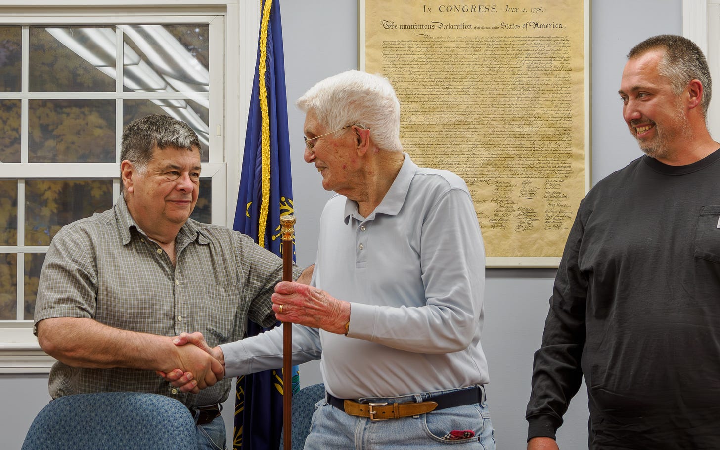
In a revival of a tradition, the New Ipswich Board of Selectman presented a replica of the Boston Post Cane to Roland Coates as the oldest citizen of the town. (96 years, 7 months).
September 2009
Previously Edna Shorey Fifield, was the holder of the New Ipswich cane for 10 years, passed away at the age of 103. Mrs. Fifield was born in Presque Isle, Maine, on September 21, 1906, the daughter of Mildred (Oldenburgh) and Almonzo Shorey.


Phenomenal account of the trail. Is Grand View Farm still in existence?
What I like about the account is that the trek was made in the planning stages of the trail. Direct your question to the "Friends of the Wapack" I'll ask around but this is the link: https://wapack.org/history/